
Determining Wind Speed for Paddlers
Is it too windy to paddle?
Tip: Paddle upwind first, then at the end of your paddle let the wind push you back to you car. In our Seattle classes in summer, the NE wind (comes from NE) occurs on blue sky days. We go upwind into Shilshole Marina, then back to our launch beach. Cloudy days blow from the SE which pushes the Chittenden Locks outgoing current out even faster, so we go towards the Locks using eddies on the sides, then take the wind (and Locks current) back to the Elks. With a SW wind, we find wind protection in the marina and by the Locks which are in a protected bay. We rarely get a E or W wind. Pay attention to wind at your regular paddling spot and figure out what the patterns are throughout the year.
My 4 Tools for Determining Wind Speed and Direction –
– My backyard bamboo. When it’s 2-5 knots, the leaves are shaking. 6-10 knots, the branches are moving and the tip may be pushed over. 11-15 knots, the top half of the bamboo is bent over. 16-20 knots, the bamboo is bent over in half. The Beaufort Wind Scale is helpful in learning about wind speed.
Wind Apps
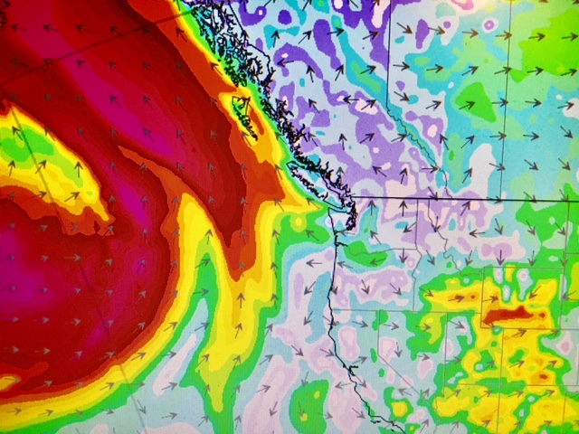
- WindAlert – A fun app I have on my phone but works on a laptop too. I check regularly. Its fun to check all over the state (and beyond) to see what’s blowing. The cover pic came from the app for a storm coming later this week. I use the free version but the paid one gives u more info if you need it. There’s other wind apps as well. Locally we have two SUP Facebook groups whose members post weather conditions in Seattle and beyond to give us real time forecasts (also great for networking).
- Windy – Windy is another option to compare forecasts with. Some paddlers prefer one over the other.
- NOAA – Using my phone or laptop, I check my local NOAA station which is at West Point in Seattle’s Discovery Park. My VHF also provides two Canadian and 2 US weather channels that run 24/7. Canadians use Environment Canada for their info. Like WindAlert these give me updated wind speeds, wind direction air temps, wind chill and a history of each for that day. You can see when the wind increased/decreased. But it also gives me a barometer reading (air pressure). If it’s decreasing, things are getting windier maybe colder too. If it’s decreasing a lot, such as -13, we have a storm coming in 2-3hrs. +13 means the storm is finishing soon (for the most part). The West Point station in Seattle is an example of having a lot of useful info . I use the regional NOAA marine forecast listings to plan trips for surfing, my classes and touring. Here’s a sample link for Puget Sound
In Person Observations
Just because it took you two hours in bad traffic to get to the beach, doesn’t mean you should go in. If the forecast said flat calm but instead its ripping 30 knots SE save it for another day. How do you tell if it’s too much? Whitecaps are 10 knots or greater. These are surfable waves, can you handle those? If not, look for a protected area to paddle in. Sometimes it’s the opposite.
You expected a storm, but instead it’s glassy calm. You won’t know until you check it in person. Note that sometimes my bamboo leaves may flutter slightly but the NOAA link at West Point is going 20 knots! A in person observation may also reveal a different story than my backyard a mile away.
Check out the Tristian Gooley collection of books including ‘Reading Water’, ‘The Natural Navigator’ and more. These are useful in learning how to use natural observations to read nature vs relying on technology. View the collection here.
Going solo? Here’s some things to think about.
Any questions give me a holler: www.salmonbaypaddle.com / 206.465.7167 / Seattle
Check out our year round Kayak Surf Ski and SUP classes in Seattle – beginning to advanced instruction and PSUPA Certification.